NASA Black Marble Product
Product User GuidePI - Zhuosen Wang (UMD/NASA GSFC)
Product ATBDCo-Is: Miguel Román (Leidos), Virginia Kalb (NASA GSFC), Ranjay Shreshta (SSAI/GSFC)
Zhe Zhu (UCONN), Srija Chakraborty (USRA/GSFC), Eleanor Stokes (USRA/GSFC)

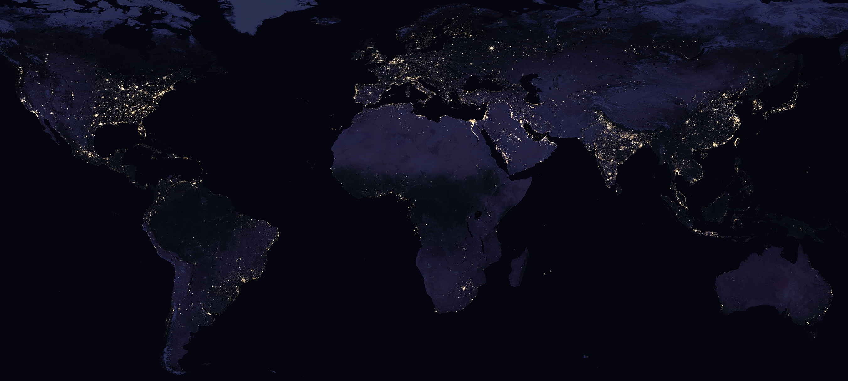
Subset of Black Marble 2016 annual composite generated using the NASA VIIRS DNB algorithm. Click on image to see
full 3km resolution global image.
The Day/Night Band (DNB) detectors that are part of the Suomi-NPP Visible Infrared Imaging Radiometer Suite (VIIRS) are pioneering a new generation of satellite products that provide global measurement of nocturnal visible and near-infrared light that are suitable for Earth science and climate studies. The VIIRS DNB's ultra-sensitivity in low-light conditions has allowed for the generation of new science-quality nighttime products due to significantly improved resolution and calibration compared to those provided previously by the Defense Meteorological Satellite Program's (DMSP) generation of nighttime lights imagery. These improvements have allowed for better monitoring of both the magnitude and signature of nighttime phenomena and anthropogenic sources of light emissions. The VIIRS Black Marble product has been used for global mapping of human activity patterns, such as tracking shipping and fishing vessels, flaring of waste natural gas, in addition to their application to humanitarian efforts, such as assessment of conflict-associated demographic changes and mapping impoverishment. The NASA Black Marble algorithm produces cloud-free imagery that have been corrected for atmospheric, terrain, lunar BRDF, thermal, and straylight effects. The corrected nighttime radiances, resulting in a superior retrieval of nighttime lights at short time scales and a reduction in background noise, enable quantitative analyses of daily, seasonal and annual variations. For additional information about the Black Marble products and applications, visit NASA's Black Marble web site.
Product Summary for VNP46A1/A2

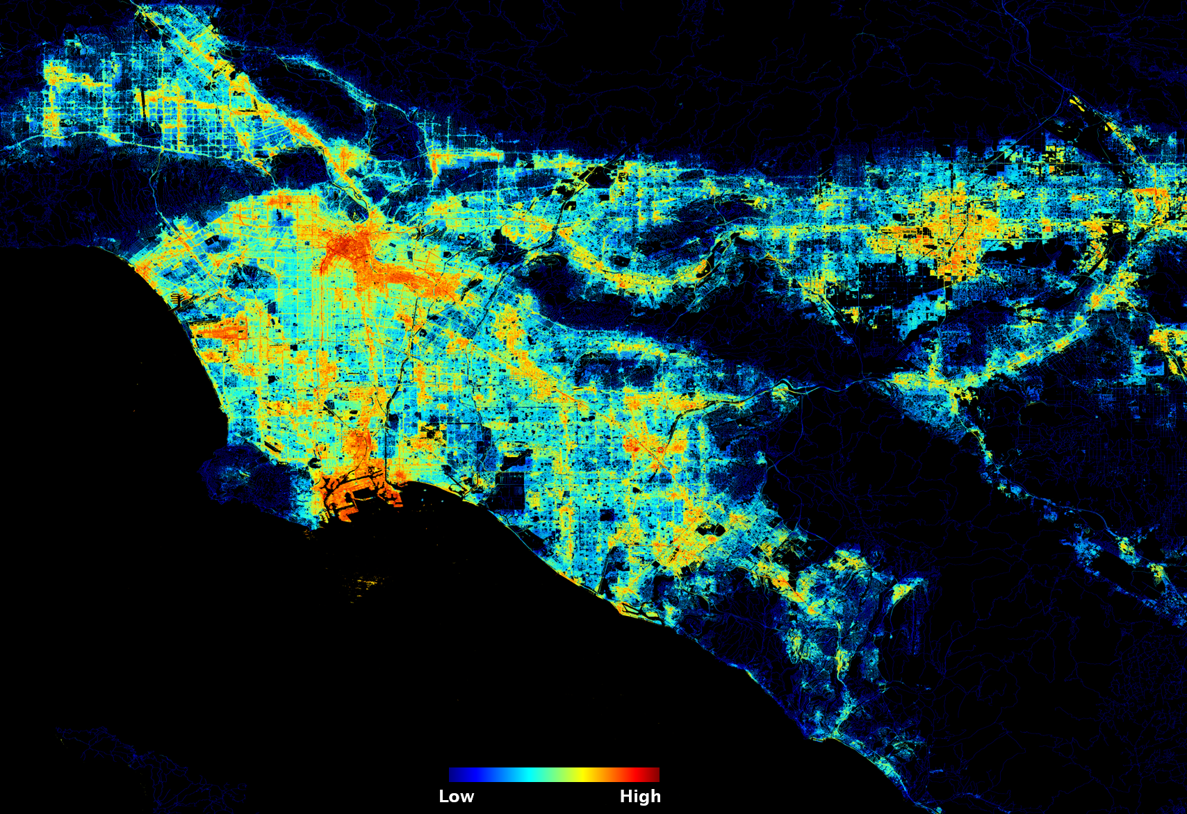
Black Marble HD 2016 annual composite over Los Angeles, CA generated using the NASA VIIRS
DNB algorithm. Click on image to see larger version.
VNP46A1 is a daily, top-of-atmosphere, at-sensor nighttime radiance product called VIIRS/NPP Daily Gridded Day Night Band 15 arc-second Linear Lat Lon Grid Night. The product contains 26 Science Data Sets (SDS) that include sensor radiance, zenith and azimuth angles (at-sensor, solar, and lunar), cloud-mask flags, time, shortwave IR radiance, brightness temperatures, VIIRS quality flags, moon phase angle, and moon illumination fraction. It also provides Quality Flag (QF) information specific to the cloud-mask, VIIRS moderate-resolution bands M10, M11, M12, M13, M15, M16, and DNB.
VNP46A2 is a daily moonlight- and atmosphere-corrected Nighttime Lights (NTL) product called VIIRS/NPP Gap-Filled Lunar BRDF-Adjusted Nighttime Lights Daily L3 Global 500m Linear Lat Lon Grid. This product contains seven Science Data Sets (SDS) that include DNB BRDF-Corrected NTL, Gap-Filled DNB BRDF-Corrected NTL, DNB Lunar Irradiance, Latest High-Quality Retrieval, Mandatory Quality Flag, Cloud Mask Quality Flag and Snow Flag.
Both VNP46A1 and VNP46A2 products are provided in standard Hierarchical Data Format–Earth Observing System 5 (HDF-EOS5) format. Currently, this collection is available from January 19, 2012 and forward. Products from the VIIRS sensor aboard JPSS-1 (J1) will be also be available starting in mid-2023.
Product Details and DAAC links
| Product Name | SNPP | JPSS-1 |
|---|---|---|
| Daily Gridded Day Night Band 500m Linear Lat Lon Grid Night | VNP46A1 | VJ146A1 |
| Gap-Filled Lunar BRDF-Adjusted Nighttime Lights Daily L3 Global 500m Linear Lat Lon Grid | VNP46A2 | VJ146A2 |
| Lunar BRDF-Adjusted Nighttime Lights Monthly L3 Global 15 arc second Linear Lat Lon Grid | VNP46A3 | VJ146A3 |
| Lunar BRDF-Adjusted Nighttime Lights Yearly L3 Global 15 arc second Linear Lat Lon Grid | VNP46A4 | VJ146A4 |
References
Román, M.O., Wang, Z., Sun, Q., Kalb, V., Miller, S.D., Molthan, A., Schultz, L., Bell, J., Stokes, E.C., Pandey, B. and Seto, K.C.,
et al. 2018. NASA's Black Marble nighttime lights product suite. Remote Sensing of Environment, 210, pp.113-143, DOI:10.1016/j.rse.2018.03.017.
Wang, Z., Román, M.O., Kalb,V., Miller, S.D., Zhang, J., and Shrestha, R.M. 2021. Quantifying uncertainties in nighttime light retrievals from Suomi-NPP and NOAA-20 VIIRS Day/Night Band data. Remote Sensing of Environment, 263 (112557), DOI:10.1016/j.rse.2021.112557.
Román, M.O., Stokes, E.C., Shrestha, R.M., Wang, Z., Schultz, L., Sepúlveda Carlo, E.A., Sun, Q., Bell, J., Molthan, A., Kalb, V., Ji, C.,Seto, K.C., McClain, S.N., and Enenkel, M. 2019. Satellite-based assessment of electricity restoration efforts in Puerto Rico after Hurricane Maria. PLoS ONE, 14, DOI:10.1371/journal.pone.0218883.
Wang, Z., Román, M.O., Sun, Q., Molthan, A.L., Schultz, L.A., and Kalb, V. 2018. Monitoring Disaster-Related Power Outages Using NASA Black Marble Nighttime Light Product. ISPRS - International Archives of the Photogrammetry, Remote Sensing and Spatial Information Sciences XLII-3, pp.1853-1856, DOI:10.5194/isprs-archives-xlii-3-1853-2018.
Enenkel, M., Shrestha, R.M., Stokes, E.C., Román, M.O., Wang, Z., Espinosa, T.M., Hajzmanova, I., Ginnetti, J., Vinck, P. 2019. Emergencies do not stop at night: Advanced analysis of displacement based on satellite-derived nighttime light observations. IBM Journal of Research and Development, DOI:10.1147/JRD.2019.2954404
Román, M.O., and Stokes, E.C. 2015. Holidays in lights: Tracking cultural patterns in demand for energy services. Earth's Future 3 (6), pp. 182-205, DOI:10.1002/2014ef000285


